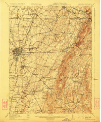
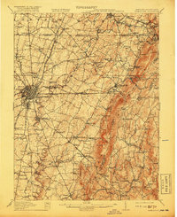
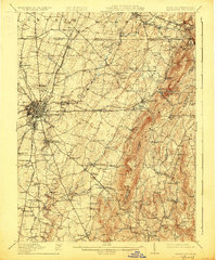
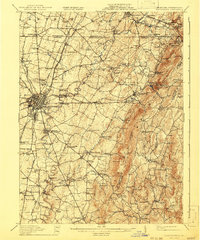
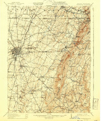
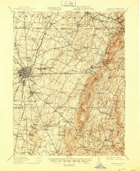
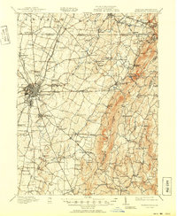
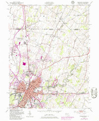
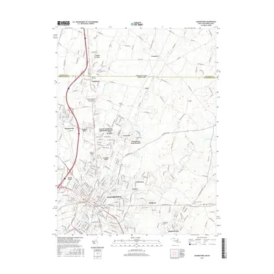
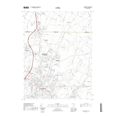
1912 Map of Hagerstown
USGS Topo · Published 1923About this map
Hagerstown serves as a dense industrial and transit hub in this early twentieth-century survey, surrounded by a productive landscape of limestone valleys and the rising ridgelines of South Mountain and Catoctin Mountain. The map captures a sophisticated transportation network at its peak, including the Cumberland Valley RR and the Hagerstown and Frederick Electric Ry, which linked the valley's orchards and farms to the urban center. Along the winding course of Antietam Creek, traditional industry is evident at Rose Mill and Strites Mill, while the limestone soil supported numerous small crossroads communities like Funkstown and Benevola.
Find a feature on this map
133 named features on this map. Tap any name to fly to it.
Don’t see what you’re looking for? This feature index may not catch every label — zoom into the map to look around manually.
Map Details
Editions of this 1912 Hagerstown Map
9 editions found


Historical Maps of Hagerstown Through Time
13 maps found

1909 Hagerstown
Washington County, MD
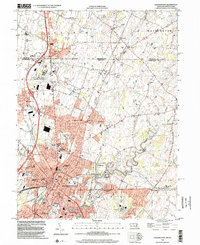
1912 Hagerstown
Washington County, MD

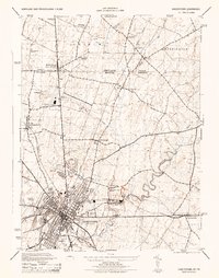
1942 Hagerstown
Washington County, MD

1943 Hagerstown
Washington County, MD
1944 Hagerstown
Washington County, MD
1953 Hagerstown
Washington County, MD

1983 Hagerstown
Washington County, MD
1999 Hagerstown
Washington County, MD
2011 Hagerstown
Washington County, MD
2014 Hagerstown
Washington County, MD
2016 Hagerstown
Washington County, MD
2019 Hagerstown
Washington County, MD
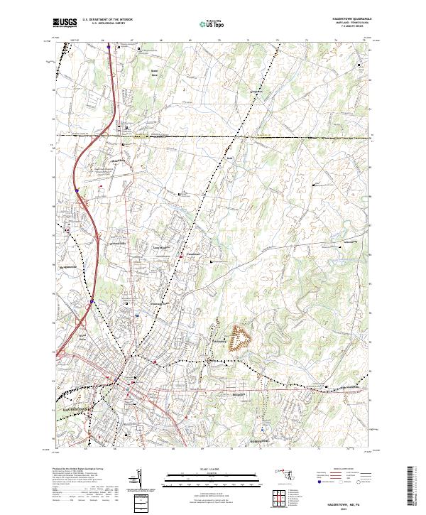
2023 Hagerstown
Washington County, MD