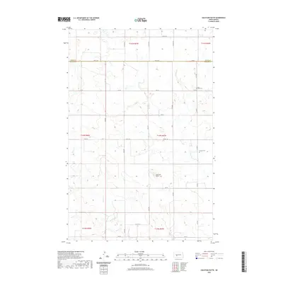
2020 Map of Hailstone Butte
USGS Topo · Published 2020About this map
Hailstone Butte rises as a prominent landmark above the surrounding drainage basins of Hailstone Cr and Wilson Cr. This 2020 map reflects the expansive agricultural layout of the rural northern Great Plains, divided by a precise grid of section lines and gravel roads such as Co HWY 140. For local historians and genealogists, the map identifies key community burial grounds, including Saint Markus Cem in the north and Bluegrass Cem to the south. The terrain is defined by the high divides between creek beds, showing how early settlement patterns followed the natural flow of water through this high-prairie landscape where the boundaries of Oliver and Morton counties meet.
Find a feature on this map
22 named features on this map. Tap any name to fly to it.
Don’t see what you’re looking for? This feature index may not catch every label — zoom into the map to look around manually.
Map Details
Editions of this 2020 Hailstone Butte Map
This is the sole edition of this map. No revisions or reprints were ever made.
Other maps of this area

1954 · Bismarck
USGS Topo · 1:250,000

1954 · McClusky
USGS Topo · 1:250,000

1958 · Bismarck
USGS Topo · 1:250,000

1958 · McClusky
USGS Topo · 1:250,000

1960 · North Almont
USGS Topo · 1:24,000

1960 · Dengate
USGS Topo · 1:24,000

1960 · Glen Ullin
USGS Topo · 1:24,000

1970 · Bluegrass
USGS Topo · 1:24,000

1970 · Hailstone Butte
USGS Topo · 1:24,000

1970 · Glen Ullin NE
USGS Topo · 1:24,000