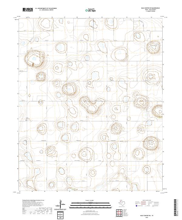
2022 Map of Hale Center SW
USGS Topo · Published 2022About this map
Center Plains Cem serves as a primary historical landmark in this agricultural landscape of the Texas Panhandle, situated near the intersection of Fm 179 and Co RD 185. The topography is defined by the subtle, high-plains depressions and draws characteristic of Hale County, organized by a rigid grid of rural routes. The road network, including Fm 1914 and E Hereford Rd, follows the section lines of the Llano Estacado, illustrating the systematic division of land for large-scale farming. Named local thoroughfares like Ferguson Rd and Nix Rd in the northeast corner suggest established family holdings in a region where water management and cotton or grain production have long dictated the rhythm of life and settlement patterns.
Find a feature on this map
28 named features on this map. Tap any name to fly to it.
Don’t see what you’re looking for? This feature index may not catch every label — zoom into the map to look around manually.
Map Details
Editions of this 2022 Hale Center SW Map
This is the sole edition of this map. No revisions or reprints were ever made.
Other maps of this area

1954 · Lubbock
USGS Topo · 1:250,000

1954 · Plainview
USGS Topo · 1:250,000

1954 · Clovis
USGS Topo · 1:250,000

1954 · Brownfield
USGS Topo · 1:250,000

1957 · Anton
USGS Topo · 1:62,500

1957 · Abernathy
USGS Topo · 1:62,500

1958 · Brownfield
USGS Topo · 1:250,000

1958 · Clovis
USGS Topo · 1:250,000

1958 · Plainview
USGS Topo · 1:250,000

1962 · Brownfield
USGS Topo · 1:250,000