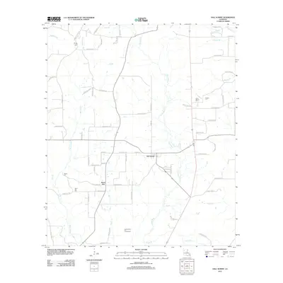
2012 Map of Hall Summit
USGS Topo · Published 2012About this map
Hall Summit and Mount Zion anchor this rural landscape in Red River Parish, Louisiana, as it appeared in the early 2010s. The region is defined by a dense network of watercourses and parish roads, where Grand Bayou and Bayou Chicot drain the low-lying terrain. The map's layout reflects a history of small-town settlement and local industry, prominently featuring the Bracky Branch Oil and Gas Field in the southern portion of the quadrangle. For those researching local family history, several burial grounds are scattered throughout the countryside, including Spring Hill Cem, Social Springs Cem, and Huggins Cem. The infrastructure is characterized by numerous small bridges and crossings, such as Carter Br and Red Br, which navigate the many tributaries like Low Cr and Dry Cr that feed into the larger bayou system.
Find a feature on this map
72 named features on this map. Tap any name to fly to it.
Don’t see what you’re looking for? This feature index may not catch every label — zoom into the map to look around manually.
Map Details
Editions of this 2012 Hall Summit Map
This is the sole edition of this map. No revisions or reprints were ever made.
Other maps of this area

1941 · East Point
USGS Topo · 1:31,680

1941 · Bossier Point
USGS Topo · 1:31,680

1947 · Ringgold
USGS Topo · 1:62,500

1947 · Ashland
USGS Topo · 1:62,500

1948 · Coushatta
USGS Topo · 1:62,500

1948 · Jamestown
USGS Topo · 1:62,500

1949 · Jamestown
USGS Topo · 1:62,500

1955 · Shreveport
USGS Topo · 1:250,000

1956 · Shreveport
USGS Topo · 1:250,000

1956 · Ringgold
USGS Topo · 1:62,500