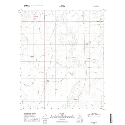
2018 Map of Hall Summit
USGS Topo · Published 2018About this map
Grand Bayou meanders through the heart of this Red River Parish landscape, defining the drainage patterns south of Hall Summit. This agricultural and forested region is characterized by a high density of rural burial sites, serving as a critical resource for genealogists researching families from the Mount Zion and Martin areas. The map reveals the intricate network of parish roads, such as Springhill Church Rd and Wiggins Rd, that connect isolated homesteads and community centers like Mount Zion Cem and Social Springs Cem. Small tributaries including Spring Hill Br and Bayou Chicot segment the terrain, while the northern border captures the transition into Bienville Parish. The placement of these cemeteries and named creeks alongside established routes like La 514 provides a clear view of the settlement footprint in this part of Louisiana during the early 21st century.
Find a feature on this map
79 named features on this map. Tap any name to fly to it.
Don’t see what you’re looking for? This feature index may not catch every label — zoom into the map to look around manually.
Map Details
Editions of this 2018 Hall Summit Map
This is the sole edition of this map. No revisions or reprints were ever made.
Other maps of this area

1941 · East Point
USGS Topo · 1:31,680

1941 · Bossier Point
USGS Topo · 1:31,680

1947 · Ringgold
USGS Topo · 1:62,500

1947 · Ashland
USGS Topo · 1:62,500

1948 · Coushatta
USGS Topo · 1:62,500

1948 · Jamestown
USGS Topo · 1:62,500

1949 · Jamestown
USGS Topo · 1:62,500

1955 · Shreveport
USGS Topo · 1:250,000

1956 · Shreveport
USGS Topo · 1:250,000

1956 · Ringgold
USGS Topo · 1:62,500