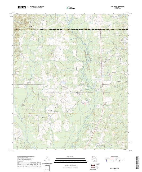
2024 Map of Hall Summit
USGS Topo · Published 2024About this map
Hall Summit serves as the central hub for this modern look at northern Louisiana, where the landscape is defined by the winding network of bayous and creeks. A mix of rural settlements and agricultural land spans the border of Bienville and Red River Parishes, connected by a dense grid of local roads including State Rte 783 and Springhill Church Rd. For those researching local families, the map is punctuated by numerous historical burial grounds like Spring Hill Cem, Social Springs Cem, and Watson Cem. The drainage patterns are intricate, with Grand Bayou and its many tributaries, such as Madden Branch and Lick Branch, carving through the terrain near the small community of Mount Zion. The spatial arrangement of these cemeteries and watercourses provides a clear view of how development followed the natural flow of the land in this corner of the state.
Find a feature on this map
80 named features on this map. Tap any name to fly to it.
Don’t see what you’re looking for? This feature index may not catch every label — zoom into the map to look around manually.
Map Details
Editions of this 2024 Hall Summit Map
This is the sole edition of this map. No revisions or reprints were ever made.
Other maps of this area

1941 · East Point
USGS Topo · 1:31,680

1941 · Bossier Point
USGS Topo · 1:31,680

1947 · Ringgold
USGS Topo · 1:62,500

1947 · Ashland
USGS Topo · 1:62,500

1948 · Coushatta
USGS Topo · 1:62,500

1948 · Jamestown
USGS Topo · 1:62,500

1949 · Jamestown
USGS Topo · 1:62,500

1955 · Shreveport
USGS Topo · 1:250,000

1956 · Shreveport
USGS Topo · 1:250,000

1956 · Ringgold
USGS Topo · 1:62,500