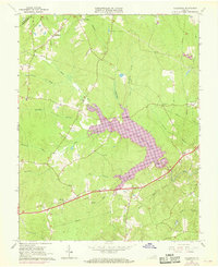
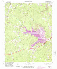
1963 Map of Hallsboro
USGS Topo · Published 1969About this map
The Swift Creek Reservoir serves as a dominant central feature on this 1963 survey of Chesterfield County, which also incorporates purple revisions from 1968. This period of Virginia's history reflects the transition from rural farming landscapes to more modern infrastructure, as evidenced by the numerous pipelines and the presence of the Southside Speedway near the eastern edge. Local genealogy is well-documented through scattered family burial grounds such as Cheatham Cem, Lester Cem, and Fuqua Cem, alongside long-standing community centers like Mt Hermon Ch and Tomahawk Ch. The northern section is marked by the Southern railroad line running through Hallsboro and Dry Bridge, while the southern reaches show the early layouts of Winterpock and Otterdale. The complex drainage system of Swift Creek and its many branches, including Blackman Creek and Nuttree Branch, defines the area's natural topography.
Find a feature on this map
36 named features on this map. Tap any name to fly to it.
Don’t see what you’re looking for? This feature index may not catch every label — zoom into the map to look around manually.
Map Details
Editions of this 1963 Hallsboro Map
5 editions found
Other maps of this area

1890 · Goochland
USGS Topo · 1:125,000

1892 · Goochland
USGS Topo · 1:125,000

1897 · Amelia
USGS Topo · 1:125,000

1936 · Richmond West
USGS Topo · 1:24,000

1942 · Westhampton
USGS Topo · 1:31,680

1943 · Fine Creek Mills
USGS Topo · 1:31,680

1943 · Chesterfield
USGS Topo · 1:31,680

1943 · Goodes Bridge
USGS Topo · 1:31,680

1943 · Hallsboro
USGS Topo · 1:31,680

1943 · Beach
USGS Topo · 1:24,000