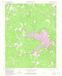
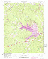
1963 Map of Hallsboro
USGS Topo · Published 1982About this map
Swift Creek Reservoir dominates this landscape in central Virginia, reflecting a period of significant suburban transformation as residential developments began to edge into traditionally rural timber and farm lands. The arrival of planned communities like Brandermill contrasts with the area's older agricultural roots, evidenced by family landmarks such as the Tomahawk Cem and Cheatham Cem.
Find a feature on this map
36 named features on this map. Tap any name to fly to it.
Don’t see what you’re looking for? This feature index may not catch every label — zoom into the map to look around manually.
Map Details
Editions of this 1963 Hallsboro Map
5 editions found
Other maps of this area

1890 · Goochland
USGS Topo · 1:125,000

1892 · Goochland
USGS Topo · 1:125,000

1897 · Amelia
USGS Topo · 1:125,000

1936 · Richmond West
USGS Topo · 1:24,000

1942 · Westhampton
USGS Topo · 1:31,680

1943 · Fine Creek Mills
USGS Topo · 1:31,680

1943 · Chesterfield
USGS Topo · 1:31,680

1943 · Goodes Bridge
USGS Topo · 1:31,680

1943 · Hallsboro
USGS Topo · 1:31,680

1943 · Beach
USGS Topo · 1:24,000