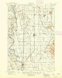
1912 Map of Halsey
USGS Topo · Published 1947About this map
The Willamette River defines the western edge of this valley landscape, its winding course creating a complex network of landforms like Ho-A-C-U-M Island, Morgan Island, and the curved shoreline at Irish Bend. To the east, the flat agricultural prairie is dotted with small agricultural hubs and railroad sidings such as Halsey, Harrisburg, and Shedd. These settlements were linked by the Southern Pacific and the Oregon Electric lines, reflecting the early 20th-century reliance on rail for moving crops and passengers through the Willamette Valley.
Find a feature on this map
73 named features on this map. Tap any name to fly to it.
Don’t see what you’re looking for? This feature index may not catch every label — zoom into the map to look around manually.
Map Details
Editions of this 1912 Halsey Map
3 editions found
Other maps of this area

1909 · Harrisburg
USGS Topo · 1:31,680

1909 · Rowland
USGS Topo · 1:31,680

1909 · Elmira
USGS Topo · 1:62,500

1910 · Eugene
USGS Topo · 1:62,500

1911 · Brownsville
USGS Topo · 1:31,680

1911 · Lebanon
USGS Topo · 1:31,680

1911 · Monroe
USGS Topo · 1:31,680

1911 · Tangent
USGS Topo · 1:31,680

1911 · Inavale
USGS Topo · 1:31,680

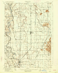
1912 · Halsey
USGS Topo · 1:62,500