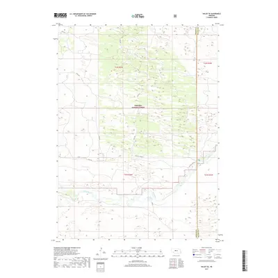
2017 Map of Halsey SE
USGS Topo · Published 2017About this map
The Dismal River carves a distinct path through the southern half of this terrain, marking a stark hydrological contrast to the surrounding sand hills. Much of the northern and central portions of the map are defined by the Nebraska National Forest, an area characterized by its unique hand-planted woodlands within the prairie. A network of rural forest roads, including Circle Rd, Natick Rd, and Davis Rd, provides access to this managed landscape. Along the eastern edge, the boundary between Thomas County and Blaine County is clearly delineated. This 2017 survey shows the convergence of the river valley and the forest interior, specifically around Whitetail Camp Rd, illustrating the modern management of these Nebraska public lands.
Find a feature on this map
11 named features on this map. Tap any name to fly to it.
Don’t see what you’re looking for? This feature index may not catch every label — zoom into the map to look around manually.
Map Details
Editions of this 2017 Halsey SE Map
This is the sole edition of this map. No revisions or reprints were ever made.
Other maps of this area

1948 · Linscott
USGS Topo · 1:62,500

1948 · Halsey
USGS Topo · 1:62,500

1950 · Linscott
USGS Topo · 1:62,500

1950 · Halsey
USGS Topo · 1:62,500

1951 · Dunning
USGS Topo · 1:62,500

1951 · Hoagland
USGS Topo · 1:62,500

1954 · North Platte
USGS Topo · 1:250,000

1956 · North Platte
USGS Topo · 1:250,000

1957 · North Platte
USGS Topo · 1:250,000

1967 · North Platte
USGS Topo · 1:250,000