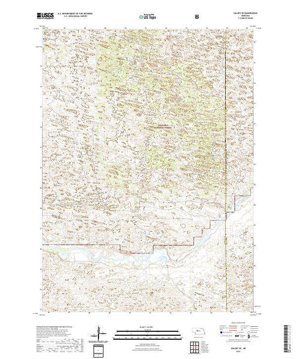
2021 Map of Halsey SE
USGS Topo · Published 2021About this map
Nebraska National Forest encompasses the majority of this landscape, reflecting a unique era of hand-planted woodland within the Nebraska Sandhills. The terrain is defined by a dense network of forest service tracks and trails, such as Poison Ivy Trl and Fenceline Trl, which navigate the complex dune topography. This 2021 survey shows a land management pattern focused on conservation and backcountry access, with the Whitetail Camp Rd providing a primary route through the wooded sections.
Find a feature on this map
14 named features on this map. Tap any name to fly to it.
Don’t see what you’re looking for? This feature index may not catch every label — zoom into the map to look around manually.
Map Details
Editions of this 2021 Halsey SE Map
This is the sole edition of this map. No revisions or reprints were ever made.
Other maps of this area

1948 · Linscott
USGS Topo · 1:62,500

1948 · Halsey
USGS Topo · 1:62,500

1950 · Linscott
USGS Topo · 1:62,500

1950 · Halsey
USGS Topo · 1:62,500

1951 · Dunning
USGS Topo · 1:62,500

1951 · Hoagland
USGS Topo · 1:62,500

1954 · North Platte
USGS Topo · 1:250,000

1956 · North Platte
USGS Topo · 1:250,000

1957 · North Platte
USGS Topo · 1:250,000

1967 · North Platte
USGS Topo · 1:250,000