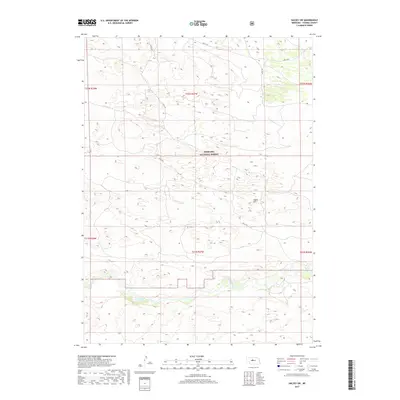
2017 Map of Halsey SW
USGS Topo · Published 2017About this map
The Nebraska National Forest dominates this section of the Sandhills, where a vast expanse of stabilized dunes and grassy hillsides characterizes the central Nebraska landscape. Flowing through the southern portion of the quadrangle, the Dismal River carves a distinct valley through the terrain, providing a vital water source and a change in elevation from the surrounding uplands. Rising above the undulating plains, Signal Hill serves as a prominent landmark for navigation and surveying. The area is intersected by Circle Rd, which winds through the public forest lands, providing access to this largely unpopulated region. The map illustrates the sparse infrastructure and remote character of the Nebraska interior during the early twenty-first century, emphasizing the scale of the protected forest system and the natural drainage patterns of the river valley.
Find a feature on this map
10 named features on this map. Tap any name to fly to it.
Don’t see what you’re looking for? This feature index may not catch every label — zoom into the map to look around manually.
Map Details
Editions of this 2017 Halsey SW Map
This is the sole edition of this map. No revisions or reprints were ever made.
Other maps of this area

1948 · Thedford
USGS Topo · 1:62,500

1948 · Halsey
USGS Topo · 1:62,500

1949 · Cody Lake
USGS Topo · 1:62,500

1950 · Thedford
USGS Topo · 1:62,500

1950 · Halsey
USGS Topo · 1:62,500

1951 · Cody Lake
USGS Topo · 1:62,500

1951 · Hoagland
USGS Topo · 1:62,500

1954 · North Platte
USGS Topo · 1:250,000

1956 · North Platte
USGS Topo · 1:250,000

1957 · North Platte
USGS Topo · 1:250,000