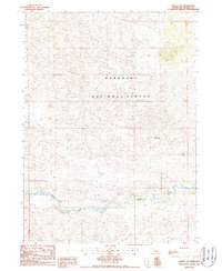
1986 Map of Halsey SW
USGS Topo · Published 1987About this map
The Dismal River carves a distinct, winding path across the southern portion of this Thomas County landscape, creating a sharp ecological contrast with the surrounding Sandhills. Much of the northern terrain is defined by the massive Nebraska National Forest, an area characterized by its unique hand-planted woodlands and undulating topography. Rising above the complex dune patterns is Signal Hill, a prominent high point that serves as a key landmark in this sparsely populated region. This 1986 survey documents a network of rugged 4wd tracks that provide the only passage through the shifting sands, illustrating the remote and specialized ranching and conservation character of the Nebraska interior during the late twentieth century.
Find a feature on this map
7 named features on this map. Tap any name to fly to it.
Don’t see what you’re looking for? This feature index may not catch every label — zoom into the map to look around manually.
Map Details
Editions of this 1986 Halsey SW Map
This is the sole edition of this map. No revisions or reprints were ever made.
Other maps of this area

1948 · Thedford
USGS Topo · 1:62,500

1948 · Halsey
USGS Topo · 1:62,500

1949 · Cody Lake
USGS Topo · 1:62,500

1950 · Thedford
USGS Topo · 1:62,500

1950 · Halsey
USGS Topo · 1:62,500

1951 · Cody Lake
USGS Topo · 1:62,500

1951 · Hoagland
USGS Topo · 1:62,500

1954 · North Platte
USGS Topo · 1:250,000

1956 · North Platte
USGS Topo · 1:250,000

1957 · North Platte
USGS Topo · 1:250,000