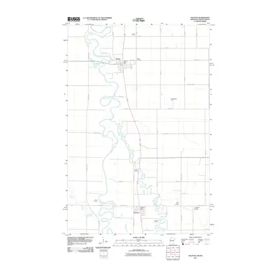
2011 Map of Halstad
USGS Topo · Published 2011About this map
The Red River of the North carves a complex, winding path through this western Norman County landscape, defining the border between Minnesota and North Dakota. The settlements of Halstad and Hendrum serve as the primary hubs, each anchored by its respective post office and surrounded by a network of agricultural section roads. This 2011 survey illustrates the rural character of the Red River Valley, where the flat terrain is interrupted only by the oxbows of the Wild Rice River and Elm River.
Find a feature on this map
41 named features on this map. Tap any name to fly to it.
Don’t see what you’re looking for? This feature index may not catch every label — zoom into the map to look around manually.
Map Details
Editions of this 2011 Halstad Map
This is the sole edition of this map. No revisions or reprints were ever made.
Other maps of this area

1918 · Hendrum
USGS Topo · 1:62,500

1924 · Ada
USGS Topo · 1:62,500

1952 · Grand Forks
USGS Topo · 1:250,000

1956 · Grand Forks
USGS Topo · 1:250,000

1963 · Shelly
USGS Topo · 1:24,000

1963 · Perley
USGS Topo · 1:24,000

1963 · Gardner
USGS Topo · 1:24,000

1963 · Halstad
USGS Topo · 1:24,000

1963 · Halstad SW
USGS Topo · 1:24,000
1964 · Caledonia
USGS Topo · 1:24,000