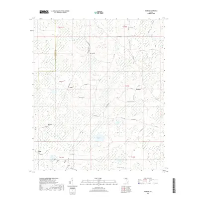
2018 Map of Hamburg
USGS Topo · Published 2018About this map
The Little Aucilla River meanders south through this corner of the Florida panhandle, anchoring a landscape of scattered rural settlements and significant wetlands. On the Madison County side of the boundary with Jefferson County, the communities of Maysland, Hamburg, and Bailey are linked by a network of local roads such as NW May's Island Rd and Co RD 150. The map is particularly valuable for genealogical research, identifying several family-named burial sites including Redding Cem, Smith Cem, and Reaper Cem. Significant water bodies like Johannah Lake, Hundred Acre Pond, and Tucker Pond reveal the low-lying, watery character of the terrain, which is further punctuated by features like Mays Island and the curiously named Devils Woodyard in the southeast quadrant. This survey documents a quiet interior region defined by its hydrology and small-scale agricultural clusters.
Find a feature on this map
52 named features on this map. Tap any name to fly to it.
Don’t see what you’re looking for? This feature index may not catch every label — zoom into the map to look around manually.
Map Details
Editions of this 2018 Hamburg Map
This is the sole edition of this map. No revisions or reprints were ever made.
Other maps of this area

1954 · Greenville
USGS Topo · 1:24,000

1954 · Greenville NE
USGS Topo · 1:24,000

1954 · Valdosta
USGS Topo · 1:250,000

1956 · Grooverville
USGS Topo · 1:24,000

1956 · Nankin
USGS Topo · 1:24,000

1956 · Baden
USGS Topo · 1:24,000

1958 · Valdosta
USGS Topo · 1:250,000

1959 · Valdosta
USGS Topo · 1:250,000

1959 · Madison
USGS Topo · 1:24,000

1960 · Cherry Lake
USGS Topo · 1:24,000