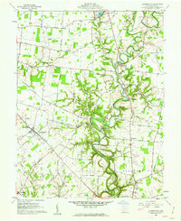
1960 Map of Hamersville
USGS Topo · Published 1962About this map
The meandering course of White Oak Creek dominates this 1960 landscape in southern Brown County, carving a deep valley through the agricultural uplands of the Virginia Military District. In Hamersville, the intersection of transport and community is evident at Liming Park and the nearby Hamersville Cem. The map documents a transition in local infrastructure, most notably the Old R R Grade tracing a path toward the southwest, indicating the former rail presence that once linked these rural hamlets.
Find a feature on this map
85 named features on this map. Tap any name to fly to it.
Don’t see what you’re looking for? This feature index may not catch every label — zoom into the map to look around manually.
Map Details
Editions of this 1960 Hamersville Map
2 editions found
Other maps of this area

1914 · Batavia
USGS Topo · 1:48,000

1916 · Batavia
USGS Topo · 1:62,500

1917 · Sardinia
USGS Topo · 1:62,500

1928 · Higginsport
USGS Topo · 1:48,000

1931 · Felicity
USGS Topo · 1:62,500

1931 · Higginsport
USGS Topo · 1:62,500

1944 · Sardinia
USGS Topo · 1:62,500

1947 · Columbus
USGS Topo · 1:250,000

1952 · Higginsport
USGS Topo · 1:24,000

1953 · Bethel
USGS Topo · 1:24,000