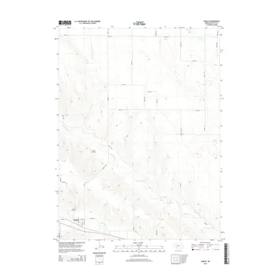
2014 Map of Hamlet
USGS Topo · Published 2014About this map
The small village of Hamlet serves as the focal point of this Hayes County landscape, situated where Frenchman Cr and Stinking Water Cr converge. The terrain is defined by the drainage patterns of these creeks, which carve through the high plains to create features like Corral Canyon. Local infrastructure follows a rigid grid of avenues and roads, including Avenue 354 and Road 733, which connect the outlying agricultural land to the town center. Within the village limits, residential life is organized around Wise St and Maple St, while the Meadow Lawn Cem sits just to the west, providing a genealogical record for families in this corner of Nebraska. This survey illustrates how early twentieth-century highway development, represented by Highway 6A, continues to shape the transport corridor along the creek valley.
Find a feature on this map
28 named features on this map. Tap any name to fly to it.
Don’t see what you’re looking for? This feature index may not catch every label — zoom into the map to look around manually.
Map Details
Editions of this 2014 Hamlet Map
This is the sole edition of this map. No revisions or reprints were ever made.
Other maps of this area

1954 · McCook
USGS Topo · 1:250,000

1957 · McCook
USGS Topo · 1:250,000

1958 · McCook
USGS Topo · 1:250,000

1973 · Palisade
USGS Topo · 1:24,000

1973 · Palisade SW
USGS Topo · 1:24,000

1973 · Wauneta SE
USGS Topo · 1:24,000

1974 · Hamlet
USGS Topo · 1:24,000

1974 · Dittons Creek SE
USGS Topo · 1:24,000

1974 · Hayes Center
USGS Topo · 1:24,000
1974 · Palisade NE
USGS Topo · 1:24,000