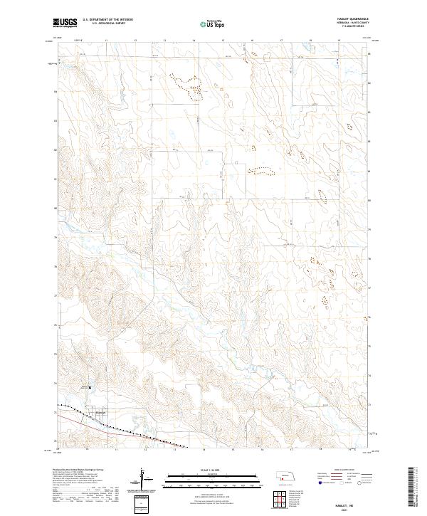
2021 Map of Hamlet
USGS Topo · Published 2021About this map
Hamlet serves as the primary settlement in this corner of Hayes County, situated in the southwest where the open plains give way to more complex drainage patterns. The community is positioned just south of Stinking Water Cr, a waterway that has carved distinct breaks across the landscape. The topographic survey reveals a systematic grid of section roads including Rd 736 and Rd 731, which connect the scattered agricultural holdings and rural infrastructure. Genealogists and local historians will find Meadow Lawn Cem located northwest of the village, serving as a permanent record for the area's families. The terrain is marked by significant natural features like Corral Canyon, illustrating the transition from flat upland fields to the eroded valleys of the Nebraska sandhills region. Modern transportation follows the path of history along Old Us Hwy 6, which runs parallel to the railroad corridor through the valley.
Find a feature on this map
26 named features on this map. Tap any name to fly to it.
Don’t see what you’re looking for? This feature index may not catch every label — zoom into the map to look around manually.
Map Details
Editions of this 2021 Hamlet Map
This is the sole edition of this map. No revisions or reprints were ever made.
Other maps of this area

1954 · McCook
USGS Topo · 1:250,000

1957 · McCook
USGS Topo · 1:250,000

1958 · McCook
USGS Topo · 1:250,000

1973 · Palisade
USGS Topo · 1:24,000

1973 · Palisade SW
USGS Topo · 1:24,000

1973 · Wauneta SE
USGS Topo · 1:24,000

1974 · Hamlet
USGS Topo · 1:24,000

1974 · Dittons Creek SE
USGS Topo · 1:24,000

1974 · Hayes Center
USGS Topo · 1:24,000
1974 · Palisade NE
USGS Topo · 1:24,000