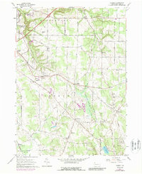
1960 Map of Hammett
USGS Topo · Published 1989About this map
The rolling landscape of Erie County south of Lake Erie is defined by a network of rural hamlets and educational institutions as they stood in 1960. Behrend Campus Pa State University occupies the northwest, set against the dramatic relief of Wintergreen Gorge. The sheet illustrates a mid-century community organized around family-named crossroads like Owens Corners, Bogus Corners, and Weeds Corners. Cultural hubs are prominent, including the St Boniface Sch & Ch complex and the Kuhl Road Speedway near the Millcreek and Harborcreek township line.
Find a feature on this map
81 named features on this map. Tap any name to fly to it.
Don’t see what you’re looking for? This feature index may not catch every label — zoom into the map to look around manually.
Map Details
Editions of this 1960 Hammett Map
3 editions found
Other maps of this area

1899 · Erie
USGS Topo · 1:62,500

1900 · Erie
USGS Topo · 1:62,500

1913 · North East
USGS Topo · 1:62,500

1915 · North East
USGS Topo · 1:62,500

1923 · Cambridge Springs
USGS Topo · 1:62,500

1925 · Cambridge Springs
USGS Topo · 1:62,500

1929 · Union City
USGS Topo · 1:62,500

1932 · Union City
USGS Topo · 1:62,500

1943 · North East
USGS Topo · 1:62,500

1943 · Cambridge Springs
USGS Topo · 1:62,500