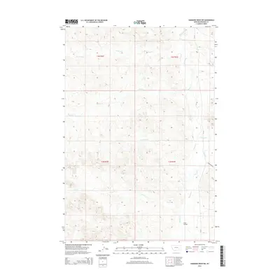
2014 Map of Hammond Draw NW
USGS Topo · Published 2014About this map
Rosebud Creek meanders through the eastern portions of this Rosebud County landscape, serving as the primary drainage for a network of intermittent streams. The terrain is defined by the erosive patterns of the Northern Great Plains, where Sand Coulee and various creek beds have carved into the high prairie. In addition to the main waterway, the area is dissected by numerous named tributaries including Pony Creek, John Hen Creek, and Sprague Creek. Human activity is primarily limited to transportation corridors such as Mt-447 and the gravel-surfaced Snider Creek Road. The lack of formal town sites highlights the rural ranching character of this region in the early 21st century, where the landscape remains dominated by large-scale land divisions and natural watercourses.
Find a feature on this map
15 named features on this map. Tap any name to fly to it.
Don’t see what you’re looking for? This feature index may not catch every label — zoom into the map to look around manually.
Map Details
Editions of this 2014 Hammond Draw NW Map
This is the sole edition of this map. No revisions or reprints were ever made.
Other maps of this area

1954 · Hardin
USGS Topo · 1:250,000

1954 · Forsyth
USGS Topo · 1:250,000

1957 · Hardin
USGS Topo · 1:250,000

1957 · Forsyth
USGS Topo · 1:250,000

1958 · Forsyth
USGS Topo · 1:250,000

1958 · Hardin
USGS Topo · 1:250,000

1971 · Colstrip SE
USGS Topo · 1:24,000

1971 · Hammond Draw NW
USGS Topo · 1:24,000

1971 · Colstrip East
USGS Topo · 1:24,000

1971 · Hammond Draw
USGS Topo · 1:24,000