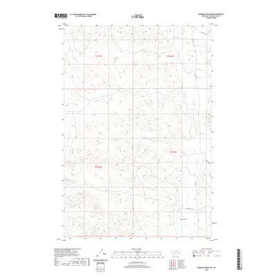
2020 Map of Hammond Draw NW
USGS Topo · Published 2020About this map
Rosebud Cr and its many seasonal tributaries carve through the heart of Rosebud County in this 2020 terrain survey. The landscape is defined by the drainage patterns of Sprague Cr, Cherry Cr, and John Hen Cr, which together shape the complex system of ridges and draws characteristic of this part of Montana. Human presence is sparse, marked primarily by rural routes such as Cherry Creek Rd and Snider Creek Rd. The wide basin of Sand Coulee in the southeast corner provides a distinct geographical contrast to the more dissected drainage areas of W Snider Cr and Pony Cr. This map captures the modern distribution of private ranching interests and local landmarks like Diamond Ranch Ln within the traditional Public Land Survey System grids of T3N R43E and T2N R43E.
Find a feature on this map
17 named features on this map. Tap any name to fly to it.
Don’t see what you’re looking for? This feature index may not catch every label — zoom into the map to look around manually.
Map Details
Editions of this 2020 Hammond Draw NW Map
This is the sole edition of this map. No revisions or reprints were ever made.
Other maps of this area

1954 · Hardin
USGS Topo · 1:250,000

1954 · Forsyth
USGS Topo · 1:250,000

1957 · Hardin
USGS Topo · 1:250,000

1957 · Forsyth
USGS Topo · 1:250,000

1958 · Forsyth
USGS Topo · 1:250,000

1958 · Hardin
USGS Topo · 1:250,000

1971 · Colstrip SE
USGS Topo · 1:24,000

1971 · Hammond Draw NW
USGS Topo · 1:24,000

1971 · Colstrip East
USGS Topo · 1:24,000

1971 · Hammond Draw
USGS Topo · 1:24,000