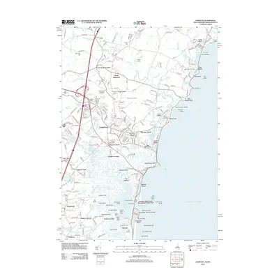
2012 Map of Hampton
USGS Topo · Published 2012About this map
The Atlantic coastline of Rockingham County defines the geography of this survey, stretching from the sandy reaches of Jenness Beach and Rye Beach south toward the complex estuary of Hampton Harbor. The shoreline is punctuated by prominent landmarks such as Great Boars Head and Lockes Neck, while the interior is a mix of dense coastal settlements and ecological preserves. The development of the early 21st century is evident in the residential clusters of North Hampton, Hampton, and Seabrook, many of which grew around historic junctions like Elmwood Corners and The Five Corners.
Find a feature on this map
245 named features on this map. Tap any name to fly to it.
Don’t see what you’re looking for? This feature index may not catch every label — zoom into the map to look around manually.
Map Details
Editions of this 2012 Hampton Map
This is the sole edition of this map. No revisions or reprints were ever made.
Other maps of this area

1888 · Newburyport
USGS Topo · 1:62,500

1890 · Newburyport
USGS Topo · 1:62,500

1893 · Dover
USGS Topo · 1:62,500

1893 · York
USGS Topo · 1:62,500

1894 · Newburyport
USGS Topo · 1:62,500

1916 · Dover
USGS Topo · 1:62,500

1918 · Dover
USGS Topo · 1:62,500

1920 · York
USGS Topo · 1:62,500

1932 · Newburyport
USGS Topo · 1:48,000

1934 · Exeter
USGS Topo · 1:62,500