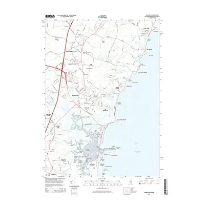
2015 Map of Hampton
USGS Topo · Published 2015About this map
The salt marshes and coastal inlets of Hampton and Hampton Beach define this section of the New Hampshire shoreline. The intricate network of tidal waterways, including Swains Creek, Blind Creek, and Tide Mill Creek, weaves through the Hampton Marshes, creating a complex landscape of islands like Hunts Island and Knowles Island. Inland, the settlement pattern is marked by traditional crossroads such as Cemetery Corners, Fogg Corner, and The Five Corners, reflecting the historical development of Rockingham County's coastal communities.
Find a feature on this map
214 named features on this map. Tap any name to fly to it.
Don’t see what you’re looking for? This feature index may not catch every label — zoom into the map to look around manually.
Map Details
Editions of this 2015 Hampton Map
This is the sole edition of this map. No revisions or reprints were ever made.
Other maps of this area

1888 · Newburyport
USGS Topo · 1:62,500

1890 · Newburyport
USGS Topo · 1:62,500

1893 · Dover
USGS Topo · 1:62,500

1893 · York
USGS Topo · 1:62,500

1894 · Newburyport
USGS Topo · 1:62,500

1916 · Dover
USGS Topo · 1:62,500

1918 · Dover
USGS Topo · 1:62,500

1920 · York
USGS Topo · 1:62,500

1932 · Newburyport
USGS Topo · 1:48,000

1934 · Exeter
USGS Topo · 1:62,500