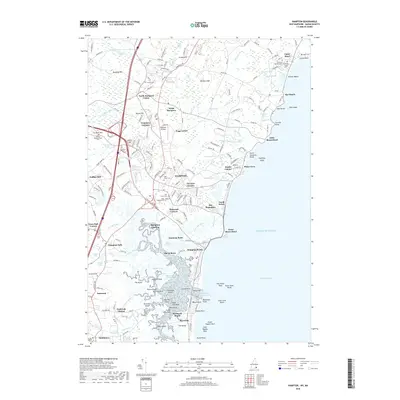
2018 Map of Hampton
USGS Topo · Published 2018About this map
Hampton and its coastal neighbors define this shoreline landscape where the Atlantic meets a complex network of salt marshes and tidal inlets. The maritime character of the region is evident in the transition from sandy stretches like Seabrook Beach and North Beach to the rocky promontories of Little Boars Head and Great Boars Head. Inland, the settlement pattern reveals centuries of local history through family-named landmarks and clusters such as Cemetery Corners, Fogg Corner, and Elmwood Corners. Genealogists will find a high density of burial sites, including the Ye Old Neighborhood Cem, Locke Cem, and the Philbrick Family Cem. The legacy of early industry and transport is preserved in names like Coffins Mill and Hampton Landing, while the marshlands are navigated by features such as Tide Mill Creek and Blind Creek, illustrating a community deeply intertwined with its watery geography.
Find a feature on this map
157 named features on this map. Tap any name to fly to it.
Don’t see what you’re looking for? This feature index may not catch every label — zoom into the map to look around manually.
Map Details
Editions of this 2018 Hampton Map
This is the sole edition of this map. No revisions or reprints were ever made.
Other maps of this area

1888 · Newburyport
USGS Topo · 1:62,500

1890 · Newburyport
USGS Topo · 1:62,500

1893 · Dover
USGS Topo · 1:62,500

1893 · York
USGS Topo · 1:62,500

1894 · Newburyport
USGS Topo · 1:62,500

1916 · Dover
USGS Topo · 1:62,500

1918 · Dover
USGS Topo · 1:62,500

1920 · York
USGS Topo · 1:62,500

1932 · Newburyport
USGS Topo · 1:48,000

1934 · Exeter
USGS Topo · 1:62,500