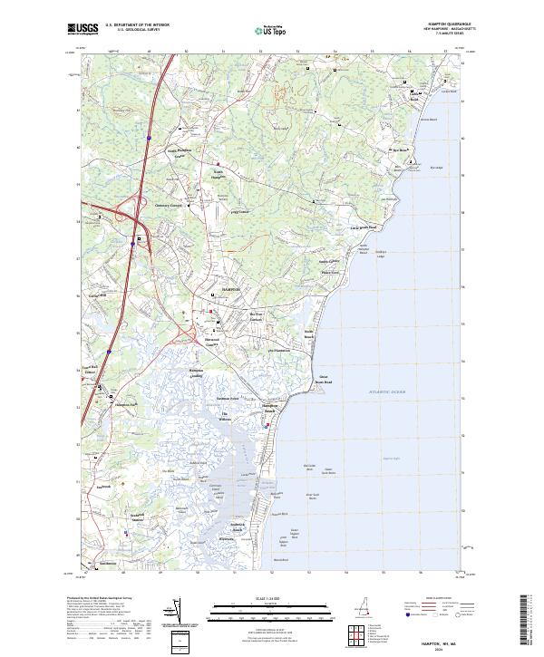
2024 Map of Hampton
USGS Topo · Published 2024About this map
The Atlantic coastline of Rockingham County defines this landscape, where tidal inlets and marshy estuaries meet the established seaside communities of Hampton and Seabrook. The intricate network of waterways, including the Hampton River, Mill Creek, and the Blackwater River, underscores the historical reliance on coastal access. Small settlements and crossroads like The Five Corners, Elmwood Corners, and Fogg Corner reveal a colonial-era land division pattern that persists alongside modern landmarks like the Hampton Airfield and Seabrook Station. Family-named cemeteries and burial grounds are scattered throughout the quadrangle, including the Marden Family Cem and the Post Road Burial Ground, offering significant data points for genealogists. From the prominent rocky outcrops of Great Boars Head to the industrial site of Coffins Mill, the map illustrates a complex coastal economy shaped by the sea and the region's early families.
Find a feature on this map
228 named features on this map. Tap any name to fly to it.
Don’t see what you’re looking for? This feature index may not catch every label — zoom into the map to look around manually.
Map Details
Editions of this 2024 Hampton Map
This is the sole edition of this map. No revisions or reprints were ever made.
Other maps of this area

1888 · Newburyport
USGS Topo · 1:62,500

1890 · Newburyport
USGS Topo · 1:62,500

1893 · Dover
USGS Topo · 1:62,500

1893 · York
USGS Topo · 1:62,500

1894 · Newburyport
USGS Topo · 1:62,500

1916 · Dover
USGS Topo · 1:62,500

1918 · Dover
USGS Topo · 1:62,500

1920 · York
USGS Topo · 1:62,500

1932 · Newburyport
USGS Topo · 1:48,000

1934 · Exeter
USGS Topo · 1:62,500