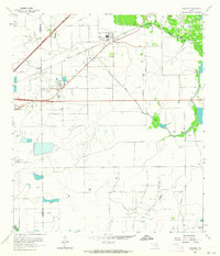
1962 Map of Hamshire
USGS Topo · Published 1964About this map
The coastal prairie of Jefferson and Chambers counties was defined by the extraction economy of the early 1960s, a landscape where traditional agricultural roads met an intensive network of petroleum infrastructure. Central to the region is Hamshire, situated along the Gulf Colorado and Santa Fe railroad, which served as a primary transportation artery for the area's industries. The map illustrates a massive industrial footprint, specifically within the Fannett Oil Field, Stowell Oil Field, and the Big Hill Oil Field, where dozens of individual oil wells, sulphur wells, and pumping stations are meticulously recorded.
Find a feature on this map
27 named features on this map. Tap any name to fly to it.
Don’t see what you’re looking for? This feature index may not catch every label — zoom into the map to look around manually.
Map Details
Editions of this 1962 Hamshire Map
2 editions found
Other maps of this area

1943 · Sea Breeze
USGS Topo · 1:24,000

1943 · Stowell
USGS Topo · 1:24,000

1943 · Fannett East
USGS Topo · 1:24,000

1945 · Fannett East
USGS Topo · 1:31,680

1945 · Nolte
USGS Topo · 1:31,680

1945 · Sea Breeze
USGS Topo · 1:31,680

1950 · Houston
USGS Topo · 1:250,000

1956 · Houston
USGS Topo · 1:250,000

1961 · Star Lake
USGS Topo · 1:24,000
1962 · Stanolind Reservoir
USGS Topo · 1:24,000