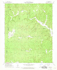
1968 Map of Handy
USGS Topo · Published 1970About this map
The Mark Twain National Forest dominates this Ozark landscape in the late 1960s, a region defined by complex drainage systems and isolated settlements. The community of Handy serves as a local anchor, centered around the Handy Ch near the junction of several forest hollows. The presence of the Tram road through the center of the forest suggests the area's history with timber extraction, cutting through the dense network of ridges and spring-fed basins.
Find a feature on this map
49 named features on this map. Tap any name to fly to it.
Don’t see what you’re looking for? This feature index may not catch every label — zoom into the map to look around manually.
Map Details
Editions of this 1968 Handy Map
3 editions found
Other maps of this area

1939 · Doniphan
USGS Topo · 1:62,500

1941 · Gatewood
USGS Topo · 1:62,500

1944 · Van Buren
USGS Topo · 1:62,500

1944 · Grandin
USGS Topo · 1:62,500

1945 · Doniphan
USGS Topo · 1:62,500

1945 · Gatewood
USGS Topo · 1:62,500

1946 · Grandin
USGS Topo · 1:62,500

1946 · Van Buren
USGS Topo · 1:62,500

1957 · Poplar Bluff
USGS Topo · 1:250,000

1959 · Poplar Bluff
USGS Topo · 1:250,000