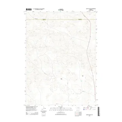
2014 Map of Happy Hollow
USGS Topo · Published 2014About this map
The Nebraska Sandhills along the border of Thomas and Logan counties are defined by a complex pattern of interdunal depressions and valleys. Notable landforms such as Happy Hollow and Green Valley dominate the landscape, representing the unique geological character of this region where water often collects in basins like Brush Lake. This 2014 survey documents the network of ranch roads and thoroughfares that navigate the challenging terrain, including Paxton Ranch Rd in the north and Sturtz Rd winding through the central dunes.
Find a feature on this map
9 named features on this map. Tap any name to fly to it.
Don’t see what you’re looking for? This feature index may not catch every label — zoom into the map to look around manually.
Map Details
Editions of this 2014 Happy Hollow Map
This is the sole edition of this map. No revisions or reprints were ever made.
Other maps of this area

1948 · Thedford
USGS Topo · 1:62,500

1948 · Halsey
USGS Topo · 1:62,500

1949 · Cody Lake
USGS Topo · 1:62,500

1950 · Thedford
USGS Topo · 1:62,500

1950 · Halsey
USGS Topo · 1:62,500

1951 · Cody Lake
USGS Topo · 1:62,500

1951 · Hoagland
USGS Topo · 1:62,500

1954 · North Platte
USGS Topo · 1:250,000

1956 · North Platte
USGS Topo · 1:250,000

1957 · North Platte
USGS Topo · 1:250,000