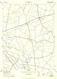
1944 Map of Harbeson
USGS Topo · Published 1944About this map
The intersection of the Pennsylvania (Delmarva Division) railroad and Milton Road anchors the village of Harbeson, a central point in this mid-1940s landscape of rural Sussex County. The terrain is defined by an intricate network of drainage ditches and branches, including Dutton Ditch and Waples Branch, which support the agricultural character of the region. Local community life is visible through scattered landmarks such as St John Church and educational sites like Stockley Sch and Hollyville School.
Find a feature on this map
50 named features on this map. Tap any name to fly to it.
Don’t see what you’re looking for? This feature index may not catch every label — zoom into the map to look around manually.
Map Details
Editions of this 1944 Harbeson Map
2 editions found
Other maps of this area

1917 · Millsboro
USGS Topo · 1:62,500

1918 · Cedar Creek
USGS Topo · 1:62,500

1918 · Rehoboth
USGS Topo · 1:62,500

1918 · Cape Henlopen
USGS Topo · 1:62,500

1919 · Cedar Creek
USGS Topo · 1:62,500

1937 · Cape Henlopen
USGS Topo · 1:62,500

1938 · Cedar Creek
USGS Topo · 1:62,500

1938 · Millsboro
USGS Topo · 1:62,500

1938 · Rehoboth
USGS Topo · 1:62,500

1943 · Fairmount
USGS Topo · 1:24,000