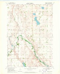
1970 Map of Harder Lake
USGS Topo · Published 1972About this map
The Des Moines River cuts through the southwestern corner of this Cottonwood County landscape, shaping the development of Windom at the turn of the 1970s. The river's winding path through Great Bend is punctuated by numerous Gravel Pits, indicating the local reliance on glacial deposits for road and construction material. In the northern sections, glacial depressions form Harder Lake, Arnolds Lake, and String Lakes, creating a distinctive prairie pothole environment.
Find a feature on this map
24 named features on this map. Tap any name to fly to it.
Don’t see what you’re looking for? This feature index may not catch every label — zoom into the map to look around manually.
Map Details
Editions of this 1970 Harder Lake Map
This is the sole edition of this map. No revisions or reprints were ever made.
Other maps of this area

1953 · New Ulm
USGS Topo · 1:250,000

1954 · Fairmont
USGS Topo · 1:250,000

1957 · New Ulm
USGS Topo · 1:250,000

1958 · New Ulm
USGS Topo · 1:250,000

1958 · Fairmont
USGS Topo · 1:250,000

1967 · New Ulm
USGS Topo · 1:250,000

1967 · Sanborn SE
USGS Topo · 1:24,000

1967 · Storden
USGS Topo · 1:24,000

1967 · Jeffers
USGS Topo · 1:24,000
1970 · Bingham Lake
USGS Topo · 1:24,000