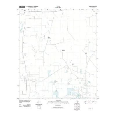
2010 Map of Hardin
USGS Topo · Published 2010About this map
Hardin and the surrounding Liberty County landscape appear here in the first decade of the 21st century, defined by a network of rural settlements and marshy lowlands. The area is marked by several distinct community hubs, including Tanner Settlement and Dowdel Settlement, which maintain their identity alongside more established towns like Hull. The geography is intricately tied to water, with Batiste Creek and Long Island Creek winding through the terrain, feeding into expansive wetlands such as Walker Marsh and Striplin Marsh.
Find a feature on this map
47 named features on this map. Tap any name to fly to it.
Don’t see what you’re looking for? This feature index may not catch every label — zoom into the map to look around manually.
Map Details
Editions of this 2010 Hardin Map
This is the sole edition of this map. No revisions or reprints were ever made.
Other maps of this area

1943 · Liberty
USGS Topo · 1:125,000

1954 · Beaumont
USGS Topo · 1:250,000

1955 · Daisetta
USGS Topo · 1:62,500

1955 · Saratoga
USGS Topo · 1:62,500

1955 · Rayburn
USGS Topo · 1:62,500

1955 · Liberty
USGS Topo · 1:62,500

1957 · Beaumont
USGS Topo · 1:250,000

1984 · Beaumont
USGS Topo · 1:250,000
1984 · Saratoga
USGS Topo · 1:24,000
1984 · Arizona Creek
USGS Topo · 1:24,000