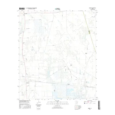
2016 Map of Hardin
USGS Topo · Published 2016About this map
Moss Hill and the city of Hardin anchor this coastal plain landscape in Liberty County, where the terrain transitions from the elevations of Hawkins Hill into the expansive wetlands of the Big Thicket region. The map reveals a complex network of bayous and marshes, including the significant Striplin Marsh and Walker Marsh, alongside open stretches of Batiste Prairie and Mayhaw Prairie. These grasslands and wetlands were historically vital to the local cattle and timber economies.
Find a feature on this map
70 named features on this map. Tap any name to fly to it.
Don’t see what you’re looking for? This feature index may not catch every label — zoom into the map to look around manually.
Map Details
Editions of this 2016 Hardin Map
This is the sole edition of this map. No revisions or reprints were ever made.
Other maps of this area

1943 · Liberty
USGS Topo · 1:125,000

1954 · Beaumont
USGS Topo · 1:250,000

1955 · Daisetta
USGS Topo · 1:62,500

1955 · Saratoga
USGS Topo · 1:62,500

1955 · Rayburn
USGS Topo · 1:62,500

1955 · Liberty
USGS Topo · 1:62,500

1957 · Beaumont
USGS Topo · 1:250,000

1984 · Beaumont
USGS Topo · 1:250,000
1984 · Saratoga
USGS Topo · 1:24,000
1984 · Arizona Creek
USGS Topo · 1:24,000