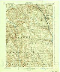
1903 Map of Harford
USGS Topo · Published 1934About this map
The Tioughnioga River corridor and the narrow valleys of southern New York define this early 20th-century landscape, where river and rail networks dictated the region's growth. Along the eastern edge, the Delaware Lackawanna and Western RR tracks parallel the river through Marathon and Killawog, while the Lehigh Valley RR (Auburn Division) snakes through the southwestern hills to serve Richford and Berkshire.
Find a feature on this map
49 named features on this map. Tap any name to fly to it.
Don’t see what you’re looking for? This feature index may not catch every label — zoom into the map to look around manually.
Map Details
Editions of this 1903 Harford Map
5 editions found
Other maps of this area

1898 · Moravia
USGS Topo · 1:62,500

1900 · Dryden
USGS Topo · 1:62,500

1901 · Apalachin
USGS Topo · 1:62,500

1902 · Moravia
USGS Topo · 1:62,500

1903 · Cortland
USGS Topo · 1:62,500

1903 · Owego
USGS Topo · 1:62,500

1903 · Harford
USGS Topo · 1:62,500

1904 · Binghamton
USGS Topo · 1:62,500

1904 · Greene
USGS Topo · 1:62,500

1904 · Apalachin
USGS Topo · 1:62,500