
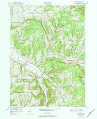
1976 Map of Harford
USGS Topo · Published 1984About this map
The Birthplace of John D Rockefeller stands as a notable historical marker in this rural landscape where the boundaries of Cortland Co and Tioga Co meet. The terrain is defined by significant ridges and deep valleys, including Gee Hill and Virgil Mtn, which frame the agricultural and residential pockets of the region. Settlement patterns follow the natural corridor of the East Branch Owego Creek, where the rail history of the area is preserved in labels for Harford (North Harford Sta) and Harford Mills (Mills Sta).
Find a feature on this map
34 named features on this map. Tap any name to fly to it.
Don’t see what you’re looking for? This feature index may not catch every label — zoom into the map to look around manually.
Map Details
Editions of this 1976 Harford Map
2 editions found
Other maps of this area

1898 · Moravia
USGS Topo · 1:62,500

1900 · Dryden
USGS Topo · 1:62,500

1902 · Moravia
USGS Topo · 1:62,500

1903 · Cortland
USGS Topo · 1:62,500

1903 · Harford
USGS Topo · 1:62,500

1906 · Catatonk
USGS Topo · 1:125,000

1942 · Groton
USGS Topo · 1:24,000

1943 · Groton
USGS Topo · 1:31,680

1944 · Cortland
USGS Topo · 1:31,680
1944 · Mc Graw
USGS Topo · 1:31,680