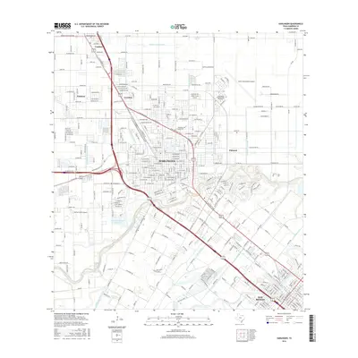
2016 Map of Harlingen
USGS Topo · Published 2016About this map
Harlingen and its neighbors in the Rio Grande Valley are defined by an intricate network of irrigation and transportation corridors. This modern topographic view traces the engineered landscape of the South Texas plains, where the Arroyo Colorado winds through a dense grid of canals, including the Number Seven Canal and Harlingen Main Canal. The development pattern reflects a transition from agricultural roots, seen at Shofner Farms Airport, to regional infrastructure like the Valley International Airport and the sprawling campus of Texas State Technical Coll Harlingen.
Find a feature on this map
327 named features on this map. Tap any name to fly to it.
Don’t see what you’re looking for? This feature index may not catch every label — zoom into the map to look around manually.
Map Details
Editions of this 2016 Harlingen Map
This is the sole edition of this map. No revisions or reprints were ever made.
Other maps of this area

1929 · Rio Hondo
USGS Topo · 1:24,000

1929 · Harlingen
USGS Topo · 1:24,000

1929 · Santa Rosa
USGS Topo · 1:24,000

1929 · Santa Maria
USGS Topo · 1:24,000

1929 · La Feria
USGS Topo · 1:24,000

1929 · La Paloma
USGS Topo · 1:24,000

1930 · Barreda
USGS Topo · 1:24,000

1932 · Combes
USGS Topo · 1:31,680

1932 · Rio Hondo
USGS Topo · 1:31,680

1932 · Harlingen
USGS Topo · 1:31,680