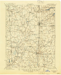
1918 Map of Harrington
USGS Topo · Published 1945About this map
Harrington serves as the central hub of this early twentieth-century survey, situated at the busy intersection of the Philadelphia, Baltimore, and Washington railroad lines. The landscape is a intricate network of agricultural crossroads and rural education centers, including specialized landmarks like Coon Den School, Potash School, and Hardscrabble School. These numerous schools, often named for local families or nearby geography, suggest a highly distributed population of farming families during this era.
Find a feature on this map
97 named features on this map. Tap any name to fly to it.
Don’t see what you’re looking for? This feature index may not catch every label — zoom into the map to look around manually.
Map Details
Editions of this 1918 Harrington Map
4 editions found
Other maps of this area

1899 · Vineland
USGS Topo · 1:125,000

1899 · Dover
USGS Topo · 1:125,000

1905 · Denton
USGS Topo · 1:62,500

1905 · Barclay
USGS Topo · 1:62,500

1905 · Hurlock
USGS Topo · 1:62,500

1906 · Dover
USGS Topo · 1:125,000

1915 · Seaford
USGS Topo · 1:62,500

1917 · Millsboro
USGS Topo · 1:62,500

1918 · Cedar Creek
USGS Topo · 1:62,500

1918 · Harrington
USGS Topo · 1:62,500