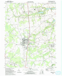
1993 Map of Harrington
USGS Topo · Published 1993About this map
The Harrington city center, featuring the Baptist Ch and City Hall, anchors this landscape at the intersection of local industry and agriculture. Large State Fairgrounds dominate the southern edge of the city, while the surrounding Kent County countryside is dotted with long-established family crossroads like Melvins Crossroads and Marvels Crossroads. To the east, the village of Houston sits along the rail line, surrounded by drainage systems such as Messicks Ditch and Beaverdam Branch.
Find a feature on this map
84 named features on this map. Tap any name to fly to it.
Don’t see what you’re looking for? This feature index may not catch every label — zoom into the map to look around manually.
Map Details
Editions of this 1993 Harrington Map
This is the sole edition of this map. No revisions or reprints were ever made.
Other maps of this area

1899 · Vineland
USGS Topo · 1:125,000

1899 · Dover
USGS Topo · 1:125,000

1906 · Dover
USGS Topo · 1:125,000

1918 · Cedar Creek
USGS Topo · 1:62,500

1918 · Harrington
USGS Topo · 1:62,500

1919 · Cedar Creek
USGS Topo · 1:62,500

1919 · Vineland
USGS Topo · 1:125,000

1920 · Dover
USGS Topo · 1:125,000

1926 · Wyoming
USGS Topo · 1:48,000

1930 · Wyoming
USGS Topo · 1:62,500