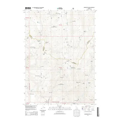
2013 Map of Harrington Peak
USGS Topo · Published 2013About this map
Caribou National Forest dominates this section of the southeastern Idaho highlands, where the Aspen Range and the Preuss Range converge. The landscape is defined by a series of significant canyons and hollows, most notably Georgetown Canyon and its many tributaries like Rolph Canyon and Grant Canyon. This 2013 survey illustrates the hydrological importance of the area, noting several high-elevation water sources including Hess Spring, Pritchert Spring, and the Big Basin Ponds.
Find a feature on this map
50 named features on this map. Tap any name to fly to it.
Don’t see what you’re looking for? This feature index may not catch every label — zoom into the map to look around manually.
Map Details
Editions of this 2013 Harrington Peak Map
This is the sole edition of this map. No revisions or reprints were ever made.
Other maps of this area

1909 · Montpelier
USGS Topo · 1:125,000

1911 · Montpelier
USGS Topo · 1:125,000

1911 · Slug Creek
USGS Topo · 1:62,500

1915 · Crow Creek
USGS Topo · 1:62,500

1949 · Johnson Creek
USGS Topo · 1:24,000

1949 · Stewart Flat
USGS Topo · 1:24,000

1949 · Dry Valley
USGS Topo · 1:24,000

1949 · Snowdrift Mountain
USGS Topo · 1:24,000

1951 · Stewart Flat
USGS Topo · 1:24,000
1951 · Dry Valley
USGS Topo · 1:24,000