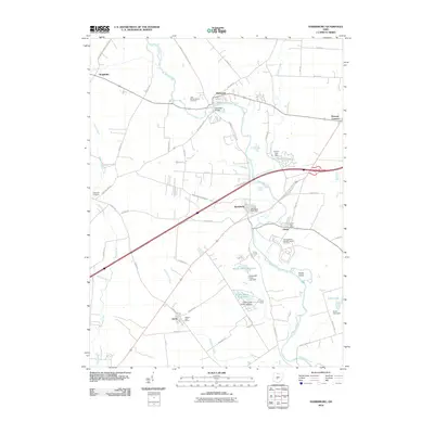
2010 Map of Harrisburg
USGS Topo · Published 2010About this map
Big Darby Creek meanders through the heart of this central Ohio landscape, serving as the primary geographical anchor for settlements like Harrisburg, Darbydale, and Orient. The map documents a predominantly rural and agricultural region where small communities are interconnected by a dense network of country roads such as Harrisburg Georgesville Rd and London Rd. A notable point of historical interest is the Orient Feeble Minded Institute Cemetery, which, along with the Little Pennsylvania Cemetery and Fitzgerald Cemetery, provides significant data for genealogical research.
Find a feature on this map
62 named features on this map. Tap any name to fly to it.
Don’t see what you’re looking for? This feature index may not catch every label — zoom into the map to look around manually.
Map Details
Editions of this 2010 Harrisburg Map
This is the sole edition of this map. No revisions or reprints were ever made.
Other maps of this area

1906 · Mt Sterling
USGS Topo · 1:62,500

1907 · London
USGS Topo · 1:62,500

1911 · Era
USGS Topo · 1:62,500

1913 · Era
USGS Topo · 1:62,500

1923 · West Columbus
USGS Topo · 1:62,500

1925 · West Columbus
USGS Topo · 1:62,500

1943 · Era
USGS Topo · 1:62,500

1947 · Columbus
USGS Topo · 1:250,000

1955 · Harrisburg
USGS Topo · 1:24,000
1955 · Commercial Point
USGS Topo · 1:24,000