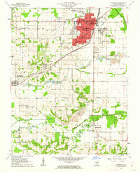
1961 Map of Harrisburg
USGS Topo · Published 1962About this map
The city of Harrisburg serves as the focal point of this Saline County study, revealing a bustling regional hub centered on its Courthouse and the New York Central rail lines. The landscape is defined by the industrial footprint of the Southern Illinois coalfields, characterized by the Sahara Mine No 16 and extensive Strip Mine operations that flank the established settlements. To the south, the terrain transitions into the protected woodlands of the Shawnee National Forest, where the South Fork Saline River meanders toward the Old Channel. This 1961 field check captures a period of transition where traditional rural landmarks, such as Cain Sch and Mt Pleasant Cem, persist alongside modern developments like the Drive-in Theater in Pankeyville and the Radio Tower (WSIL-TV), illustrating the post-war evolution of the Illinois coal belt.
Find a feature on this map
52 named features on this map. Tap any name to fly to it.
Don’t see what you’re looking for? This feature index may not catch every label — zoom into the map to look around manually.
Map Details
Editions of this 1961 Harrisburg Map
2 editions found
Other maps of this area

1905 · Eldorado
USGS Topo · 1:62,500

1906 · Eldorado
USGS Topo · 1:62,500

1908 · Galatia
USGS Topo · 1:62,500

1916 · Equality
USGS Topo · 1:62,500

1925 · Harrisburg
USGS Topo · 1:62,500

1938 · Galatia
USGS Topo · 1:62,500

1939 · Harrisburg
USGS Topo · 1:62,500

1949 · Paducah
USGS Topo · 1:250,000

1950 · Paducah
USGS Topo · 1:250,000

1954 · Paducah
USGS Topo · 1:250,000