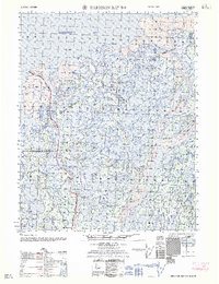
1962 Map of Harrison Bay B-2
USGS Topo · Published 1962About this map
The Colville River Delta dominates this Arctic landscape, where a complex network of waterways like the Nechelik Channel and Tamayayak Channel weave through the tundra toward Harrison Bay. Prepared by the Army Map Service using photogrammetric methods from the late 1950s, the map reveals the intricate braided nature of the Colville River and its various distributaries, including the Kupigruax Channel.
Find a feature on this map
15 named features on this map. Tap any name to fly to it.
Don’t see what you’re looking for? This feature index may not catch every label — zoom into the map to look around manually.
Map Details
Editions of this 1962 Harrison Bay B-2 Map
This is the sole edition of this map. No revisions or reprints were ever made.
Other maps of this area

1951 · Harrison Bay
USGS Topo · 1:250,000

1955 · Harrison Bay
USGS Topo · 1:250,000

1955 · Harrison Bay C-1
USGS Topo · 1:63,360

1955 · Harrison Bay B-3
USGS Topo · 1:63,360
1955 · Harrison Bay C-3
USGS Topo · 1:63,360

1955 · Harrison Bay B-2
USGS Topo · 1:63,360

1955 · Harrison Bay B-1
USGS Topo · 1:63,360

1955 · Harrison Bay A-2
USGS Topo · 1:63,360

1955 · Harrison Bay A-3
USGS Topo · 1:63,360
1955 · Harrison Bay A-1
USGS Topo · 1:63,360