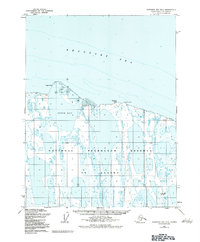
1955 Map of Harrison Bay D-5
USGS Topo · Published 1983About this map
The Beaufort Sea coast of northern Alaska is captured here in a 1955 survey, highlighting a landscape defined by the National Petroleum Reserve in Alaska. This Arctic shoreline, though largely composed of intricate wetlands and unnamed lakes, features isolated outposts of human activity such as the Esook Trading Post located near Cameron Point. The geography reveals a low-lying coastal plain where the land meets Pogik Bay, a region increasingly significant for its resource potential during the mid-20th century. The inclusion of the Cape Halkett No 1 Well in the southeast corner provides a specific marker of early exploration efforts in this remote territory. This sheet serves as a clear record of the intersection between traditional trading routes and the emerging industrial interests of the mid-century Arctic.
Find a feature on this map
7 named features on this map. Tap any name to fly to it.
Don’t see what you’re looking for? This feature index may not catch every label — zoom into the map to look around manually.
Map Details
Editions of this 1955 Harrison Bay D-5 Map
3 editions found
Other maps of this area

1951 · Harrison Bay
USGS Topo · 1:250,000

1951 · Teshekpuk
USGS Topo · 1:250,000

1955 · Harrison Bay
USGS Topo · 1:250,000

1955 · Teshekpuk
USGS Topo · 1:250,000

1955 · Harrison Bay D-4
USGS Topo · 1:63,360

1955 · Harrison Bay C-5
USGS Topo · 1:63,360

1955 · Harrison Bay D-5
USGS Topo · 1:63,360

1955 · Teshekpuk D-1
USGS Topo · 1:63,360

1955 · Harrison Bay C-4
USGS Topo · 1:63,360
1955 · Teshekpuk C-1
USGS Topo · 1:63,360