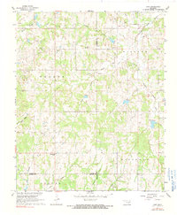
1967 Map of Hart
USGS Topo · Published 1991About this map
Canadian Sandy Creek and its many tributaries, including Little Canadian Sandy Creek and Burkhart Creek, define the drainage patterns across this Oklahoma landscape. The 1960s economy is reflected in the extensive oil and gas infrastructure, with the named oil fields of Walker Field, Midland Field, Fitzhugh Field, and Leeper Field occupying large portions of the terrain. Small rural settlements like Hart and Dolberg serve as focal points for local history, while the Prairie View Mission and nearby Corley Cem provide specific points of interest for genealogists tracking family roots in the region. The map also documents a heavy industrial presence of Sandpits and Gravel Pit operations, often situated near the meandering sandy creek beds.
Find a feature on this map
32 named features on this map. Tap any name to fly to it.
Don’t see what you’re looking for? This feature index may not catch every label — zoom into the map to look around manually.
Map Details
Editions of this 1967 Hart Map
2 editions found
Other maps of this area

1898 · Pauls Valley
USGS Topo · 1:125,000

1901 · Stonewall
USGS Topo · 1:125,000

1902 · Pauls Valley
USGS Topo · 1:125,000

1957 · Ardmore
USGS Topo · 1:250,000

1963 · Ardmore
USGS Topo · 1:250,000

1964 · Byars
USGS Topo · 1:24,000

1965 · Pauls Valley NE
USGS Topo · 1:24,000

1965 · Davis
USGS Topo · 1:24,000

1967 · Roff South
USGS Topo · 1:24,000
1967 · Vanoss
USGS Topo · 1:24,000