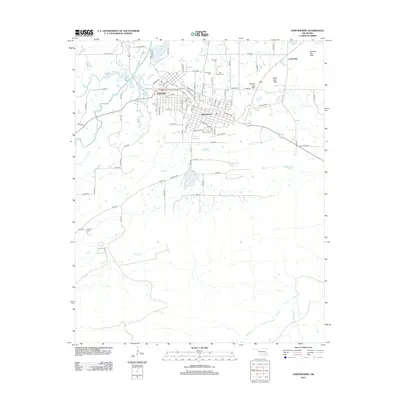
2012 Map of Hartshorne
USGS Topo · Published 2012About this map
Hartshorne and Haileyville form a dense corridor of early 21st-century settlement along Old US Hwy 270, illustrating the legacy of twin coal-mining towns in Pittsburg County. The grid systems of both communities are meticulously detailed, surrounded by a cluster of local burial grounds including Elm Park Cem, Elmwood Cem, and Holy Rosary Cem. The landscape to the north and east is defined by significant elevations like Belle Starr Mtn and Number Ten Mtn, while the southern reaches remain relatively open, drained by Blue Cr and Buffalo Cr. This survey captures the area just before significant modernization of the highway system, preserving the local road network connecting outlying areas like Centerville to the main population centers and Hartshorne Lake.
Find a feature on this map
90 named features on this map. Tap any name to fly to it.
Don’t see what you’re looking for? This feature index may not catch every label — zoom into the map to look around manually.
Map Details
Editions of this 2012 Hartshorne Map
This is the sole edition of this map. No revisions or reprints were ever made.
Other maps of this area

1898 · McAlester
USGS Topo · 1:125,000

1901 · Tuskahoma
USGS Topo · 1:125,000

1908 · Tuskahoma
USGS Topo · 1:125,000

1909 · Mc Alester
USGS Topo · 1:125,000

1909 · Tuskahoma
USGS Topo · 1:125,000

1950 · Mcalester
USGS Topo · 1:250,000

1962 · McAlester
USGS Topo · 1:250,000

1965 · McAlester
USGS Topo · 1:250,000

1967 · Krebs
USGS Topo · 1:24,000
1967 · Adamson
USGS Topo · 1:24,000