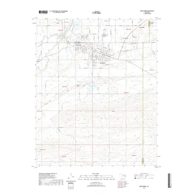
2018 Map of Hartshorne
USGS Topo · Published 2018About this map
The neighboring communities of Hartshorne and Haileyville form the urban core of this 2018 survey, reflecting a grid of streets named after tribal nations, including Choctaw Ave, Chickasaw Ave, and Seminole Ave. This area of Pittsburg County is characterized by sharp relief and sandstone ridges, with New State Mtn and Blue Mtn rising prominently above the valley floors. Local history and genealogy interests are well-represented by several burial grounds, including Holy Rosary Cem, Elm Park Cem, and the remote Sulphur Cem. Beyond the city limits, the landscape transitions into the wooded slopes of Belle Starr Mtn and Number Ten Mtn. Water resources are a defining feature of the northern section, anchored by Dow Lake and Hartshorne Lake, providing a clear view of the region's managed reservoirs and natural drainage along Blue Cr and Brushy Creek.
Find a feature on this map
80 named features on this map. Tap any name to fly to it.
Don’t see what you’re looking for? This feature index may not catch every label — zoom into the map to look around manually.
Map Details
Editions of this 2018 Hartshorne Map
This is the sole edition of this map. No revisions or reprints were ever made.
Other maps of this area

1898 · McAlester
USGS Topo · 1:125,000

1901 · Tuskahoma
USGS Topo · 1:125,000

1908 · Tuskahoma
USGS Topo · 1:125,000

1909 · Mc Alester
USGS Topo · 1:125,000

1909 · Tuskahoma
USGS Topo · 1:125,000

1950 · Mcalester
USGS Topo · 1:250,000

1962 · McAlester
USGS Topo · 1:250,000

1965 · McAlester
USGS Topo · 1:250,000

1967 · Krebs
USGS Topo · 1:24,000
1967 · Adamson
USGS Topo · 1:24,000