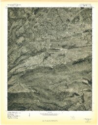
1977 Map of Hartshorne
USGS Topo · Published 1977About this map
The community of Hartshorne is the focal point of this 1970s orthophotograph, where the grid of residential streets and central business district are clearly visible against the surrounding Pittsburg County landscape. The aerial perspective captures the town's position just north of the significant ridgeline of Blue Mountain, illustrating the constraints that local topography placed on development. To the northeast, Centerville appears as a smaller cluster of activity near the base of Belle Starr Mountain.
Find a feature on this map
9 named features on this map. Tap any name to fly to it.
Don’t see what you’re looking for? This feature index may not catch every label — zoom into the map to look around manually.
Map Details
Editions of this 1977 Hartshorne Map
This is the sole edition of this map. No revisions or reprints were ever made.
Other maps of this area

1898 · McAlester
USGS Topo · 1:125,000

1901 · Tuskahoma
USGS Topo · 1:125,000

1908 · Tuskahoma
USGS Topo · 1:125,000

1909 · Mc Alester
USGS Topo · 1:125,000

1909 · Tuskahoma
USGS Topo · 1:125,000

1950 · Mcalester
USGS Topo · 1:250,000

1962 · McAlester
USGS Topo · 1:250,000

1965 · McAlester
USGS Topo · 1:250,000

1967 · Krebs
USGS Topo · 1:24,000
1967 · Adamson
USGS Topo · 1:24,000