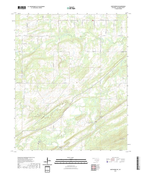
2022 Map of Hartshorne SW
USGS Topo · Published 2022About this map
Limestone Ridge and the heights of New State Mtn dominate the southern landscape of this Oklahoma survey, situated in the rugged terrain south of Hartshorne. This area is defined by the convergence of several significant watercourses, including Peaceable Creek, Brushy Creek, and Gardner Cr. The map details a quiet rural region where small communities like Arch and Craig are connected by a network of section line roads such as High Hill Rd and Four Corners Rd.
Find a feature on this map
42 named features on this map. Tap any name to fly to it.
Don’t see what you’re looking for? This feature index may not catch every label — zoom into the map to look around manually.
Map Details
Editions of this 2022 Hartshorne SW Map
This is the sole edition of this map. No revisions or reprints were ever made.
Other maps of this area

1898 · McAlester
USGS Topo · 1:125,000

1909 · Mc Alester
USGS Topo · 1:125,000

1950 · Mcalester
USGS Topo · 1:250,000

1962 · McAlester
USGS Topo · 1:250,000

1965 · McAlester
USGS Topo · 1:250,000

1967 · Pittsburg
USGS Topo · 1:24,000

1967 · Krebs
USGS Topo · 1:24,000
1967 · Mc Alester
USGS Topo · 1:24,000
1967 · Adamson
USGS Topo · 1:24,000

1967 · Hartshorne SW
USGS Topo · 1:24,000