
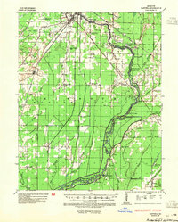
1935 Map of Harviell
USGS Topo · Published 1943About this map
The Black River meanders through this portion of Butler County, creating a complex network of bends and sloughs such as Deadman Bend and Catherine Slough. This mid-1930s landscape is defined by its rural infrastructure, featuring a high density of one-room schoolhouses like Coon Island Sch and Willow Oak Sch that served remote farmstead communities. The St Louis San Francisco Railroad and the St Louis Southwestern Railroad provide the primary transport corridors, anchoring settlements like Harviell and Qulin.
Find a feature on this map
75 named features on this map. Tap any name to fly to it.
Don’t see what you’re looking for? This feature index may not catch every label — zoom into the map to look around manually.
Map Details
Editions of this 1935 Harviell Map
2 editions found
Other maps of this area

1934 · Williamsville
USGS Topo · 1:48,000

1934 · Puxico
USGS Topo · 1:62,500

1935 · Poplar Bluff
USGS Topo · 1:62,500

1935 · Acorn
USGS Topo · 1:62,500

1935 · Rector
USGS Topo · 1:62,500

1935 · Knobel
USGS Topo · 1:62,500

1939 · Puxico
USGS Topo · 1:62,500

1939 · Poplar Bluff
USGS Topo · 1:62,500

1940 · Williamsville
USGS Topo · 1:62,500

1940 · Naylor
USGS Topo · 1:62,500