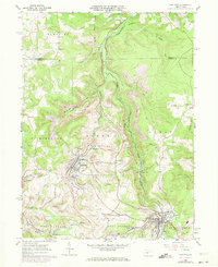
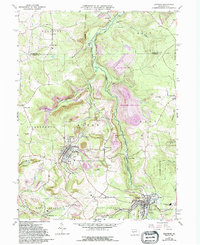
1961 Map of Hastings
USGS Topo · Published 1973About this map
The industrial and religious landscape of the Northern Cambria coal region is documented here during a period of transition in the early 1960s. The borough of Hastings sits at the heart of an area defined by extensive extraction, with Strip Mine excavations visible across the hills of Elder and Susquehanna townships. This survey reveals a dense network of Catholic heritage and ethnic settlements, including Swedetown, Slickport, and St Boniface, alongside prominent parish landmarks like St Bernard Ch and its accompanying St Bernard Cem. The infrastructure of the Penn Central railroad follows the winding course of Chest Creek, serving small communities such as Patton and Thomas Mills. Further south, the map captures the residential and industrial footprint of St Benedict and Cymbria, illustrating the tightly knit relationship between the mining economy and the social life of these valley towns.
Find a feature on this map
52 named features on this map. Tap any name to fly to it.
Don’t see what you’re looking for? This feature index may not catch every label — zoom into the map to look around manually.
Map Details
Editions of this 1961 Hastings Map
5 editions found
Other maps of this area

1902 · Patton
USGS Topo · 1:62,500

1902 · Barnesboro
USGS Topo · 1:62,500

1903 · Curwensville
USGS Topo · 1:62,500

1904 · Barnesboro
USGS Topo · 1:62,500

1904 · Patton
USGS Topo · 1:62,500

1906 · Punxsutawney
USGS Topo · 1:62,500

1939 · Curwensville
USGS Topo · 1:62,500

1939 · Punxsutawney
USGS Topo · 1:62,500

1942 · Curwensville
USGS Topo · 1:62,500

1942 · Punxsutawney
USGS Topo · 1:62,500