
1903 Map of Haubstadt
USGS Topo · Published 1903About this map
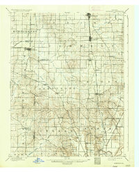
Ft. Branch and Haubstadt serve as the primary hubs in this agricultural landscape surveyed at the dawn of the twentieth century. The region is defined by a dense network of German Catholic and pioneer settlements connected by the Evansville and Terre Haute R. R. and the Illinois Central R. R.. Small crossroads communities like St. Wendells, Armstrong, and St. Joseph are interspersed among the drainages of Pigeon Creek and Flat Creek, reflecting a period of established township organization across Gibson, Vanderburg, and Posey counties.
Find a feature on this map
49 named features on this map. Tap any name to fly to it.
Don’t see what you’re looking for? This feature index may not catch every label — zoom into the map to look around manually.
Map Details
Editions of this 1903 Haubstadt Map
2 editions found
Other maps of this area

1901 · Princeton
USGS Topo · 1:62,500

1901 · Haubstadt
USGS Topo · 1:62,500

1902 · Ditney
USGS Topo · 1:125,000

1902 · Boonville
USGS Topo · 1:62,500

1903 · New Harmony
USGS Topo · 1:62,500

1903 · Petersburg
USGS Topo · 1:62,500

1903 · Princeton
USGS Topo · 1:62,500

1903 · Patoka
USGS Topo · 1:125,000

1904 · Mount Carmel
USGS Topo · 1:62,500

1905 · Newburg
USGS Topo · 1:62,500